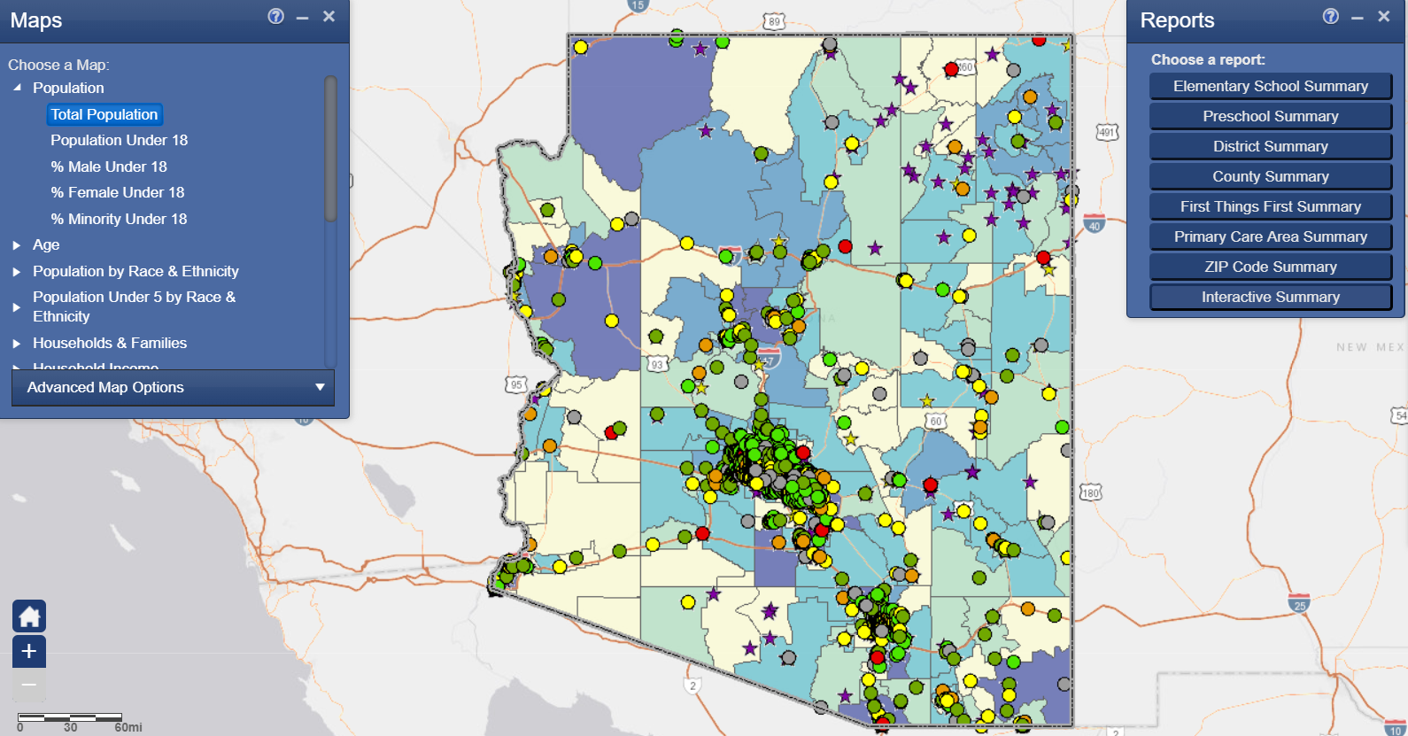
For the past two years, Kate Dobler has used an interactive mapping tool to help the First Things First Navajo/Apache Regional Partnership Council make better informed decisions on how to best use the early childhood funds dedicated to their community.
The data sets, called MapLIT, help Dobler, regional director for the FTF Navajo/Apache Region, and regional council members see complex data visually.
For example, a couple of clicks can zero in on neighborhoods and show multiple layers of information, such as income level, how many services like libraries, schools and preschools are available nearby and identify where gaps may exist.
One-stop resource
Read On Arizona, along with its partners including FTF, created MapLIT, as a one-stop resource to identify key data sets, such as census, school, health and family engagement that impact early literacy outcomes in communities.
Read On Arizona’s MapLIT provides communities with graphic views of select data for all Arizona public/charter elementary school and preschool site locations. There are menus where you select filters, with different variables. One of the best features is that the data is live because of the data agreements between the partners, Dobler said.
The FTF Navajo/Apache Region encompasses the central areas of Navajo and Apache counties, excluding the lands belonging to the Navajo Nation and the Hopi Tribe in the north and the land belonging to the White Mountain Apache Tribe in the south. One of the best examples of how the data sets have been helpful in the work being done in this rural part of the state is through the Parent Outreach and Awareness Strategy.
Reaching edges of region
“The MapLIT data showed a concentration of resources along the region’s central corridor, from Holbrook to Show Low, but if you look at the population of young children in the area, they are spread across the two counties,” Dobler said. “MapLIT allowed the council to see where the highest pockets of poverty were and made it easier in the strategic planning process to say that the council wanted to reach communities on the edge of the region—those families who are geographically distant from the central corridor of services.”
The information created a picture of the region that showed a glaring absence of licensed or regulated child care in Apache County, where 40 percent of the region’s babies, toddlers and preschoolers live.
“We know that families are not mobile, but we still need to reach those families,” Dobler said. “There are about 1,000 babies born in the region every year. Where are the babies being cared for? In the homes of family, friends and neighbors.”
This helped inform the council’s decision to fund the Family, Friend and Neighbor Strategy, which provides support to enhance the caregiver’s understanding of children’s early development and strategies to support early learning. They also learn effective health and safety practices.
The data was also used to guide grantees to focus on specific geographic areas and/or specific types of parents and caregivers. For example, if babies are being cared in the homes of grandparents or other family members, the information can help decide what types of topics should be covered.
The data also confirmed challenges that council members knew communities were facing, such as poverty and high unemployment.
“The maps can help create a picture to demonstrate the data and make it real,” Dobler said. “MapLIT highlights that it’s not a cookie cutter approach, not even within the region. The data shows you why a cookie cutter approach will not work. It’s a tool that we will continue to use for future planning.”


